 Based on the results of research on landscape, geology and geomorphic values (criteria 7 and 8), the Institute of Geosciences and Mineral Resources has made some initial assessments and conclusions about the floating value. turn on global landscape - karst geomorphology in Trang An area. This is also considered as a basis to delineate the core and buffer zone of Trang An Landscape Complex.
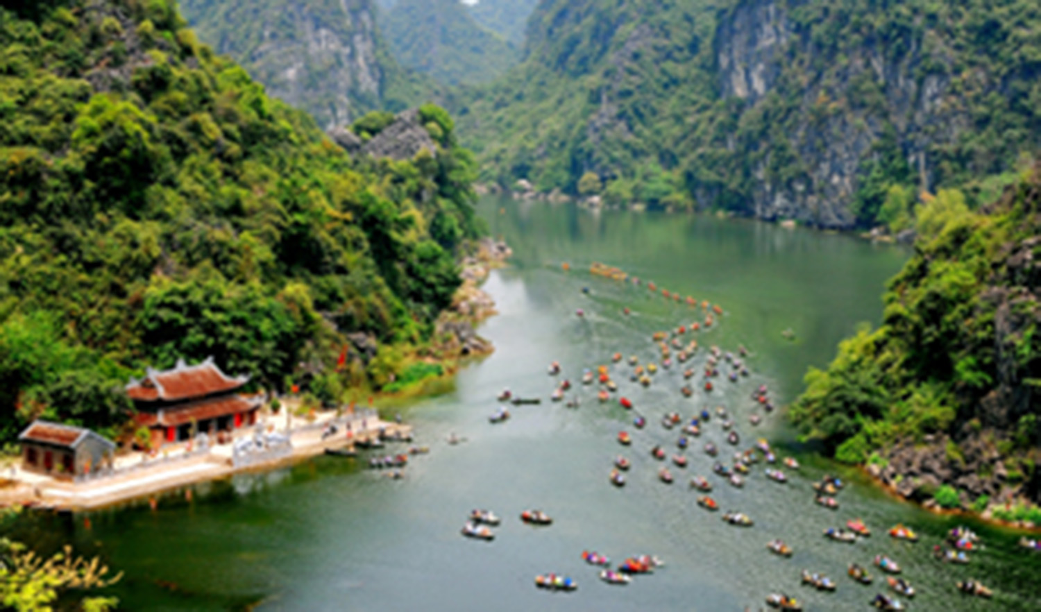
The karst landscape of Trang An scenic complex has been formed from Miocene (about 23 million years ago) with a 150-250m high neck leveling surface with migratory peaks, especially in Quaternary with types. karst landscape "peak-cluster depression", "peak-cluster vally", "peak-forest plain", karst fields with many floors of caves, sea floors, and concave waves carved into the limestone cliffs with layers of almost clinging ... All along with other archaeological, historical, cultural and social values that have created a global value for the tropical karst landscape with the bronze markers of the ancient sea have now become " fossils ”.
Trang An karst area is the southeast end of the limestone strip of the ancient Tethys ocean branch from China pulled into Vietnam. These limestone strips have formed a unique series of limestone plateau in Northwest Vietnam, after passing Cuc Phuong to Trang An, they were converted into massifs, narrow mountain ranges and valleys, increasingly widening to the East. South, along with some karst hills scattered on the plains before sinking into the sea. With the characteristics of such lacquer structure, Trang An limestone area deserves to be considered a representative representative, but also very different of the Northwest Vietnam limestone range.
The study area is divided into two parts: Northeast and Southwest through the Ninh Binh fault in the Northwest - Southeast. The results of the regional tectonic movement study have been confirmed from Pleistocene (about 2,588 million years ago) due to the expanded subsidence of the Red River Delta as well as the Tonkin Gulf, which the Northeastern part and Southeast of Trang An also subsided, with the evidence that young sediments gradually increase in thickness to the Southeast.
The study area is strongly affected by the fault system in the Northwest - Southeast; Northeast-West Asia longitude and latitude. Therefore, the long and wide valleys connected with the old plain in the Southeastern part of Trang An limestone block are very typical, narrowing the head in the Northwest and extending gradually to the Southeast. This feature clearly reflects the mechanism of operation of the Northwest - Southeast fault system which is slippery - favorable during the new tectonic period.
Also due to the strong activity in the new tectonic phase of the network of fault systems, combined with the solubility tools, the driftwood washing, the strong erosion of water in tropical climates and the more powerful by the many times of invasion of the sea, karst terrain is shown very sharply in the form of narrow formations, skeleton-like cliffs, spanning arc, blade, steering wheel (due to the combination of forms bow and blade form) encapsulate a large, hollow space inside like in Trang An. That may also be the reason for the first feudal capital of the independent feudal Vietnam - Hoa Lu capital - with relics of the Dinh-Le-Ly dynasty built here based on the danger itself. return of the "strongholds", "bows", "swords" ... unique to this area.
In particular, nowhere in the world has the scenery of a true Ha Long Bay but has become "fossilized, emerging on land" as here. The reason for making Ninh Binh's "Ancient Gulf of Hoa Lu" become a "terrestrial Ha Long Bay" lies in the characteristics of the development of the Red River Delta and then due to the human life of embankment prevent floods and sea dykes of Vietnamese people from the 9th and X centuries to the present. Although the sea has become "far away" from Trang An for thousands of years, the landscape "tropical Karst encroached upon and transformed by the sea" has remained and has become the unique pride of Ninh Binh, with its mountains, karst island carries many imprints of the sea such as clifs, lapping waves with clinging oysters, abrasive platforms, caves, etc., the landscapes of value are not inferior to those of Ha Long Bay.
A second sea level - younger, at an elevation of about 1.5-2.5 m above the modern water level is also observed in many places, including the aforementioned places, which play a role. altering and eradicating more ancient sealines, for example, on the banks of the Tam Coc - Bich Dong River, near Thai Vi Temple, at the foot of Non Nuoc Mountain ...
The third sea level, the oldest, is observed very faintly at an altitude of about 25-30m, equivalent to a cave level. A well-preserved, well-preserved example is observed in Hang Hai-Hang Ba area, that is, it has entered the deep karst karst area of Trang An. The reason for this phenomenon may be that the location was later hidden, not affected by the destructive effects of currents, waves and winds ... so it remains to this day. This sea level is thought to have formed during the late-middle Pleistocene advance (Riss-Wurn glacial period, 40,000-20,000 years ago), just before the last Wurn ice age (18,000-7,000 years ago). Especially in many places on the ancient sea stretches of 4-7m, there are still traces of oysters and ha. More than 20 samples were collected for absolute age analysis by C14 method.
Although the scale is not large, Trang An limestone blocks still clearly reflect the rule of development in the stage of karstification from the edge to the center of the block, as shown by fostering the karst landscape types: "The missing karst hills separating the plain of the sea", "the top of the valley link", "the top of the linked valley sunken" ... About geomorphology, we can consider the scope of the distribution of landscape types. The karst above is the natural basis for delineating the core and buffer zone of the heritage area.